Methods to Receive Weather Warning Information
- Television and Radio
- Emergency Notification Via Mobile Device
- NOAA Weahter Radio
- Outdoor Sirens
The warning system can only be effective if you understand the benefits and limitations of the alerting methods available. There are a great deal of warning devices and methods. It is recommended tht you take advantage of as many of them as possible. No warning method is perfect and no warning method can be guaranteed never to fail. By relying on a single method you rishk missing a warning if that system fails. By taking a broader approach and getting information from multiple sources, you are more likely to receive the warning, even if there is a failure of one of the warning methods.
It is strongly recommended that you consider the following:
- Purchase a weather alert radio if you don't already have one. ( Test is periodically to make sure it is working)
- Rely on Wireless Emergency Alerts (WEA) on your phone as one method of warning.
- Subscribe to a calling service or SMS text based alerting system if you carry a mobile device.
- REly on the sirens only for a means of outdoor alert. If you hear them, seek out additional information as soon as possible.
- Turn to broadcast radio or television for critical details and follow-up information.
Understanding Weather Warnings
Severe Weather Statement
A National Weather Service product which provides follow up information on severe weather conditions (severe thunderstorm or tornadoes) which have occurred or are currently occurring.
Flash Flood
A flood which is caused by heavy or excessive rainfall in a short period of time, generally less than 6 hours. Also, at times a dam failure can cause a flash flood, depending on the type of dam and time period during which the break occurs.
Flash Flood Warning
Issued to inform the public, emergency management, and cooperating agencies that flash flooding is in progress, imminent, or highly likely.
Flash Flood Watch
Issued to indicate current or developing hydrologic conditions that are favorable for flash flooding in and close to the watch area, but the occurrence is neither certain or imminent.
Flash Flood Statement
A statement by the NWS which provides follow-up information on flash flood watches and warnings.
Urban and Small Stream Flooding
Flooding of small streams, streets, and low-lying areas, such as railroad underpasses and urban storm drains. This type of flooding is mainly an inconvenience and is generally not life threatening nor is it significantly damaging to property.
Urban and Small Stream Flood Advisory
This advisory alerts the public to flooding which is generally only an inconvenience (not life-threatening) to those living in the affected area. Issued when heavy rain will cause flooding of streets and low-lying places in urban areas. Also used if small rural or urban streams
are expected to reach or exceed bankfull. Some damage to homes or roads could occur.
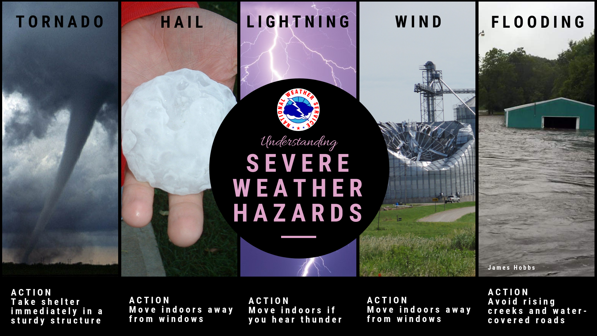
Severe Thunderstorm
A thunderstorm that produces a tornado, winds of at least 58 mph (50 knots or ~93 km/h), and/or hail at least 1" in diameter. Structural wind damage may imply the occurrence of a severe thunderstorm. A thunderstorm wind equal to or greater than 40 mph (35 knots or ~64 km/h) and/or hail of at least ½" is defined as approaching severe.
Guide for determining hail sizes:
less than 0.50" Pea
0.50" - Marble/Mothball
0.75" - Dime/Penny
0.88" - Nickel
1.00" - Quarter
1.25" - Half Dollar
1.50" - Walnut/Ping Pong
1.75" - Golf Ball
2.00" - Hen Egg
2.50" - Tennis Ball
2.75" - Baseball
3.00" - Tea Cup
4.00" - Grapefruit
4.50" - Softball
Severe Thunderstorm Watch
This is issued by the National Weather Service when conditions are favorable for the development of severe thunderstorms in and close to the watch area. A severe thunderstorm by definition is a thunderstorm that produces one inch hail or larger in diameter and/or winds equal or exceed 58 miles an hour. The size of the watch can vary depending on the weather situation. They are usually issued for a duration of 4 to 8 hours. They are normally issued well in advance of the actual occurrence of severe weather. During the watch, people should review severe thunderstorm safety rules and be prepared to move a place of safety if threatening weather approaches.
A Severe Thunderstorm Watch is issued by the Storm Prediction Center in Norman, Oklahoma. Prior to the issuance of a Severe Thunderstorm
Watch, SPC will usually contact the affected local National Weather Service Forecast Office (see map above) and they will discuss what their
current thinking is on the weather situation. Afterwards, SPC will issue a preliminary Severe Thunderstorm Watch and then the affected NWFO
will thenadjust the watch (adding or eliminating counties/parishes) and then issue it to the public by way of a Watch Redefining Statement.
During the watch, the NWFO will keep the public informed on what is happening in the watch area and also let the
public know when the watch has expired or been cancelled
Severe Thunderstorm Warning
This is issued when either a severe thunderstorm is indicated by the WSR-88D radar or a spotter reports a thunderstorm producing hail one inch or larger in diameter and/or winds equal or exceed 58 miles an hour; therefore, people in the affected area should seek safe shelter immediately. Severe thunderstorms can produce tornadoes with little or no advance warning. Lightning frequency is not a criteria for issuing a severe thunderstorm warning. They are usually issued for a duration of one hour. They can be issued without a Severe Thunderstorm Watch being already in effect.
Like a Tornado Warning, the Severe Thunderstorm Warning is issued by your National Weather Service Forecast Office (see map above). Severe Thunderstorm Warnings will include where the storm was located, what towns will be affected by the severe thunderstorm, and the primary threat associated with the severe thunderstorm warning. If the severe thunderstorm will affect the nearshore or coastal waters, it will be issued as the combined product--Severe Thunderstorm Warning and Special Marine Warning. If the severe thunderstorm is also causing torrential rains, this warning may also be combined with a Flash Flood Warning. If there is an ampersand (&) symbol at the bottom of the warning, it indicates that the warning was issued as a result of a severe weather report.
After it has been issued, the affected NWFO will follow it up periodically with Severe Weather Statements. These statements will contain updated information on the severe thunderstorm and they will also let the public know when the warning is no longer in effect.
Tornado
A violently rotating column of air, usually pendant to a cumulonimbus, with circulation reaching the ground. It nearly always starts as a funnel cloud and may be accompanied by a loud roaring noise. On a local scale, it is the most destructive of all atmospheric phenomena.
Tornado Watch
This is issued by the National Weather Service when conditions are favorable for the development of tornadoes in and close to the watch area. Their size can vary depending on the weather situation. They are usually issued for a duration of 4 to 8 hours. They normally are issued well in advance of the actual occurrence of severe weather. During the watch, people should review tornado safety rules and be prepared to move a place of safety if threatening weather approaches.
A Tornado Watch is issued by the Storm Prediction Center (SPC) in Norman, Oklahoma. Prior to the issuance of a Tornado Watch, SPC will usually contact the affected local National Weather Forecast Office (NWFO), see map below, and they will discuss what their current thinking is on the weather situation. Afterwards, SPC will issue a preliminary Tornado Watch and then the affected NWFO will then adjust the watch (adding or eliminating counties/parishes) and then issue it to the public. After adjusting the watch, the NWFO will let the public know which counties are included by way of a Watch Redefining Statement. During the watch, the NWFO will keep the public informed on what is happening in the watch area and also let the public know when the watch has expired or been cancelled.
Tornado Warning
This is issued when a tornado is indicated by the WSR-88D radar or sighted by spotters; therefore, people in the affected area should seek safe shelter immediately. They can be issued without a Tornado Watch being already in effect. They are usually issued for a duration of around 30 minutes.
A Tornado Warning is issued by your local National Weather Service office (NWFO), see map below. It will include where the tornado was located and what towns will be in its path. If the tornado will affect the nearshore or coastal waters, it will be issued as the combined product--Tornado Warning and Special Marine Warning. If the thunderstorm which is causing the tornado is also producing torrential rains, this warning may also be combined with a Flash Flood Warning. If there is an ampersand (&) symbol at the bottom of the warning, it indicates that the warning was issued as a result of a severe weather report.
After it has been issued, the affected NWFO will followed it up periodically with Severe Weather Statements. These statements will contain updated information on the tornado and they will also let the public know when warning is no longer in effect.
For Additional Information on Weather Watches and Warnings Please Visit: